Completing atypical spatial data requires field work with GPS. For many years on this way we verify and enrich traffic information, touristic, nature and others on our maps.
- work with devices ensuring 2–5 metres accuracy
- walking tracks, tracks made by car or by bike, with 2 metres sampling
- POI with attributes according to needs
- shp, gpx, kml, kmz, dxf files
- data sheets of laser measurements
- tracks with date and time of measurement, useful in verification of roads and routes
- POI, determining the position with an accuracy of 1:25 000 scale maps, with styles containing information on a number of specific attributes as object category, name, special features, administrative affiliation
- odistances and azimuths of POI
|
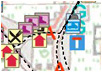
gathering tracks and POIs
|
|
|
bicycle with GPS device
|
|