Systematically expanding resources of available statistical data give possibility of creating either simple or advanced presentations of the region, county or commune.


- pdf vector format file with georeferency and layers, scalable without loss of quality
- possibility of switching on and off any layer
- printing from A4 size to 1×1 m or more
- storage server
- set of maps presenting wide spectrum of statistical data, connected with administrative division units
Samples of the offered maps:
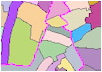
| map of distribution of common data |
 |
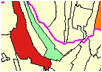
| map of distribution of isolated data |
 |
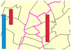
| map with bar diagrams |
 |
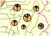
| map with circle diagrams |
 |