We are able to provide a map of The World, The Europe or any country. From drafts to detail ellaboration as in encyclopaedia. In any scale, content or design.


- pdf vector or eps format, scalable without loss of quality
- raster jpg file for websites
- licence for number of copies, volume or unlimited
- any scale and size, from 10×10 cm to 3×3 m and more
- design by Polkart or according to your vision
- jpg file for authorization
- political divide
- capitals, main cities, rivers and lakes
- full topographical content or selected according to wishes
- tourist and folk attractions
- possibility of adding any desired information
- vivid hill-shading for the mountains or hipsometrical scale, on demand
Samples of the offered maps:
| . |
 |
 |
| map of The World1:40 000 000– 90 x 50 cm size |
 |
 |
| map of The World1:90 000 000– 40 x 26 cm size |
 |
 |
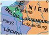
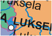
| map of The Europe1:20 000 000– 26 x 28 cm size |
 |
 |
| . |
|
|
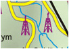
| map of Iceland1:450 000– 117 x 81 cm size |
 |
 |
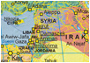
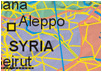
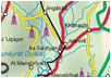
| map of Iraq1:2 500 000– rozmiar 38 x 54 cm |
 |
 |