Large amount of ready maps and access to up-to-date spatial databases provide the opportunity to offer map’s background for your portal. In relation to the maps of global suppliers, operating in the market, it will be distinguished by content, timeliness and reliability. And originality against your competition.


- raster jpg, bmp, png, tiff files with georeferency
- resolution appropriate to display of maps in portals, such 180 dpi or better
- WGS-84 or GoogleMaps datum, Poland92, UTM, Mercator or other projections
- possibility of zooming out the maps
- possibilty of corelation with open access free maps
- possibility of display any spatial data, among others KML, KMZ, GPX files
- full topographical-touristic content corresponding to 1:50 000 scale
- possibility of adding new data sets or removing redundant ones
- vivid hill-shading and contour lines, high density of roads and built-up-areas, plenty of names, full touristic content
Samples of portals with offered solutions:
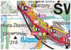
| Wirtual Carpathian Mountains(Wirtualne Karpaty) |
 |
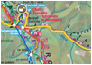
| Together on the route(Razem na szlaku.pl) |
 |
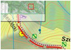
| Touristic map(mapa-turystyczna.pl) |
 |
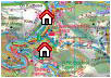
| Your Bieszczady(www.twojebieszczady.pl) |
 |
| Planet of mountains(Planeta Gór) |
 |