Extensive archive of atlases and maps from all over the World, access to unique web sites and digital databases, guarantee high quality of elaborated maps. Many years’ educational experience makes our maps readable and easy in use.


- pdf vector or eps format, scalable without loss of quality
- raster jpg file for websites
- licence for number of copies, volume or unlimited
- any scale and size, from 2×2 cm to A3
- design by Polkart or according to your vision
- jpg file for authorization
- highlighted main subject of the map
- topographical content in the background
- capitals, main cities, rivers and lakes
- tourist and folk attractions
- possibility of adding any desired information
- vivid hill-shading for the mountains or hipsometrical scale
Samples of the offered maps:
| . |
 |
| map of ocean currents |
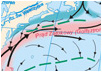 |
| map of pressure and winds in the world |
 |
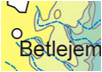
| map of Jordan river and Dead Sea |
 |
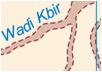
| map of intermittent rivers in north Libya |
 |
| map of GDP in Poland by voivodships |
 |
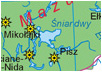
| map of touristic in Poland |
 |
| draft map of atmosphere circulation |
 |
| draft of Human expansion |
 |
| draft of cartographical projection |
 |
| . |
|
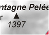
| hill-shading map of Martinique |
 |
| map of cruise over the Bahamas |
 |
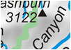
| map of Yellowstone National Park |
 |
| a map of Switzerland with high density of motorways |
 |
| map of temples’ set in Angkor |
 |
| simply city-map of centre of Dublin |
 |
| detailed city-map of Hong Kong |
 |
| city-map of monumental centre of St. Petersburg |
 |
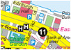
| map of Strip in Las Vegas |
 |