Besides school atlases we prepare thematical atlases too


- pdf, ai or cdr format file
- predominantly A4 size, often on double pages, there may be several smaller maps on the page
- licence for number of copies, volume or unlimited
- design fitting to whole project, established in close co-ordination with client’s designer
- hundreds of subjects from physical geography, economic geography or social geography
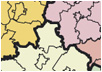
- historical maps and political maps
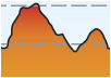
- pictorial maps and landscape maps
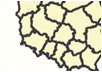
- satellite images and topographical maps
- index of geographical names
- photos, sketches, schemas and diagrams – associated with the maps
- details and readability matching to powers of user
Samples of the atlases, made last time:
|
Initial conceptof The National Atlas of Poland
GUGiK, project |
 |
 |
 |
 |
 |
|
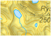
Atlas of the Tatra Mountains.Abiotic Nature
Tatra National Park |
 |
 |
 |
 |
 |